South Boston’s annual St. Patrick’s Day and Evacuation Day Parade is back this Sunday, March 16 — how lucky are we?
Boston was one of the first cities to celebrate St. Patrick’s Day in the US, so it’s no surprise that this event — presented by the South Boston Allied War Veterans Council — typically draws ~1 million spectators.

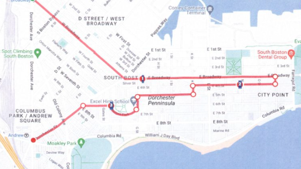
Follow the parade route to find the best spot to watch.
Image via SBAWVC
While you prepare to say “slainte” from Southie, here’s what to know before you go:
- The parade is at 11:30 a.m. It’ll be a bit shorter this year.
- The parade route begins at Broadway Station and ends at Andrew Square.
- Pro tip: Take the Red Line and avoid street closures and trying to find parking on busy streets. There’s also a free shuttle running from South Station to South Boston between 9:30 a.m. and 5 p.m.
Catch the best views from one of the many restaurants along the route, or find a spot in the crowds between Broadway Station and L Street — it’s a great place to experience the energy. If you’re looking for a less crowded area, check out Medal of Honor Park or Thomas Park.
Can’t make it? Keep up with the city’s traffic advisories + street closures in the area. Don’t be green with envy — you can also celebrate St. Patrick’s Day at a local Irish pub whenever it works best for you.
By the way, WalleHub ranked Boston the No. 1 city to go to for St. Patrick’s Day in 2025 and honestly, we 100% agree.

