Lace up your hiking boots. We’ve compiled a curated hiking guide for the Boston area with 15 trails and routes to help you plan your next adventure.
Note: Before heading out, we recommend checking park websites for further info, current trail conditions, and safest practices for the area.
Key: Easy = 🥾| Moderate = 🥾🥾 | Hard = 🥾🥾🥾

You can also bike, fish, or rent a canoe at Middlesex Fells Reservation.
Photo by @mr._thunderr
North of Boston
Battle Road Trail, 174 Liberty St., Concord
- Difficulty: 🥾
- Length: 4.6 miles, point to point
- Wheelchair accessible: Yes
- Pet-friendly: Yes, leash required
The historic trail at Minute Man National Historical Park connects sites from Meriam’s Corner to Lexington. The route follows remnants of the Battle Road unit, the site of the first Revolutionary War battle on April 19, 1775 (and the shot heard ‘round the world).
Walden Pond State Reservation Path, 915 Walden St., Concord
- Difficulty: 🥾
- Length: 1.8-mile loop
- Wheelchair accessible: Yes (Note: While the trail is technically wheelchair accessible, portions of the trail are narrow, and some reviews have said that it is not wheelchair and stroller-friendly.)
- Pet-friendly: No
Spend a Thoreau-ly perfect day at the famous Concord reservation. The hike takes ~35 minutes to complete as you encounter swimming beaches, forests, and birds. Entrance/parking fees to the reservation cost $8 for MA residents.
Saugus River Trail, 177 Forest St., Saugus
- Difficulty: 🥾🥾
- Length: 1.8-mile loop
- Wheelchair accessible: Portions
- Pet-friendly: Yes
Visit the 652-acre Breakheart Reservation state park and hike up to the vistas for sweeping views of Boston, New Hampshire, and central Massachusetts. This more secluded trail will bring you by the water and take ~40 minutes to complete.
Ipswich River Wildlife Sanctuary Trail, 87 Perkins Row, Topsfield
- Difficulty: 🥾
- Length: 3.5-mile loop
- Wheelchair accessible: No
- Pet-friendly: No
Visit between dawn and dusk to complete this easy route. It’s one of 12 trails at the sanctuary managed by the Massachusetts Audubon Society. You must purchase a $4-$7 pass to hike. Pro tip: This is one of the best nearby trails for avid bird watchers.
Skyline Outer Reservoir Loop, 4 Woodland Rd., Stoneham
- Difficulty: 🥾🥾
- Length: 7.7-mile loop
- Wheelchair accessible: No
- Pet-friendly: Yes, leash required
Head to Middlesex Fells Reservation to try this popular loop that passes the south, middle + north reservoir. Pro tip: Dogs must be on a leash on this trail, but the reservation’s Sheepfold Meadow is a designated off-leash recreation area.
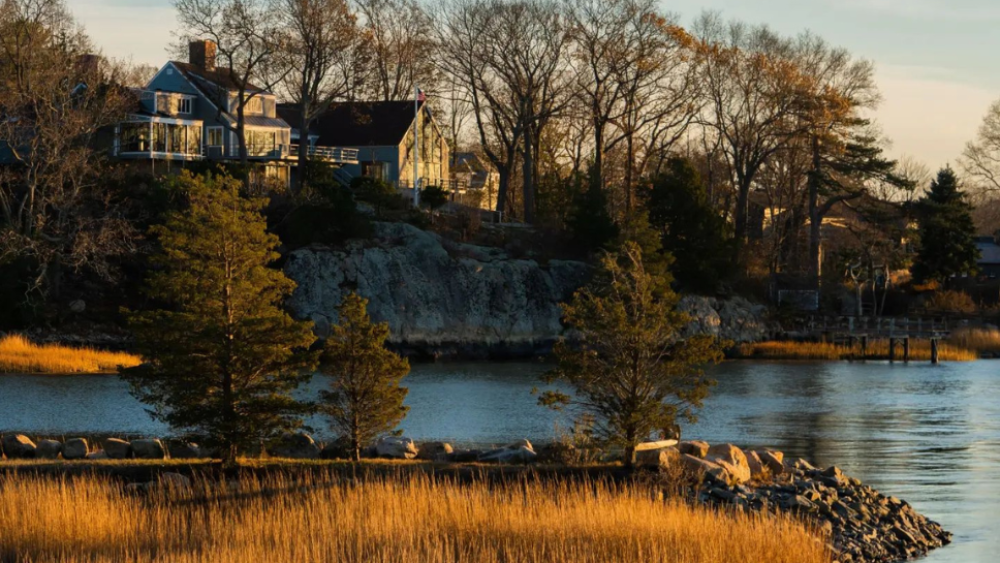
World’s End comprises four coastal drumlins, aka spoon-shaped hills formed by glaciers.
Photo by @tessavirginia_photography
South of Boston
Great Blue Hill via Skyline Trail, 695 Hillside St., Milton
- Difficulty: 🥾🥾
- Length: 3-mile loop
- Wheelchair accessible: No
- Pet-friendly: Yes, leash required
The Blue Hills Reservation is one of the most popular hiking spots in close proximity to Boston (and when you catch the views of the skyline from Eliot Tower, you’ll know why). Pro tip: Bring a trekking pole to help with your footing in steep areas.
World’s End Trail, Martin’s Lane, Hingham
- Difficulty: 🥾
- Length: 4-mile loop
- Wheelchair accessible: Yes, but all-terrain tires or adaptive/motorized equipment may be required for the surface type and grade
- Pet-friendly: Yes, leash required
Hike the area between Hingham Harbor and the Weir River for coastline charm along the Frederick Law Olmsted-designed paths. The trail is open year-round and takes ~1.5 hours to complete.
East Head Pond Trail, 194 Cranberry Rd., Carver
- Difficulty: 🥾
- Length: 2.6-mile loop
- Wheelchair accessible: No
- Pet-friendly: Yes, leash required
Known as a go-to camping and swimming destination for families, Myles Standish State Forest is the largest publicly owned recreation area in this part of Massachusetts. There are 13 miles of hiking trails to explore; the East Head Pond Trail takes ~50 minutes to complete.
Cape Cod Rail Trail, 3488 Main St., Brewster
- Difficulty: 🥾
- Length: 27.6 miles
- Wheelchair accessible: Yes
- Pet-friendly: Yes, leash required
Also a popular cycling destination, Nickerson State Park is open from sunrise to sunset, with multiple parking and trailhead options available. This trail leads hikers through six Cape Cod towns, including South Yarmouth and Dennis.
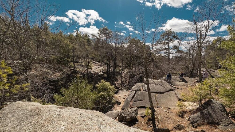
Check out The Corn Crib, The Coffin + Lovers’ Leap rock formations at Purgatory Chasm State Reservation.
Photo by @rankinphotography
West of Boston
Charley’s Loop Trail, 198 Purgatory Rd., Sutton
- Difficulty: 🥾🥾
- Length: 1-mile loop
- Wheelchair accessible: No
- Pet-friendly: Yes, leash required
Purgatory Chasm State Reservation is home to two miles of trails — which you can access from this loop — along the sites of ancient rock formations. Don’t miss Purgatory Chasm itself, a quarter-mile-long formation that towers ~70 ft high.
Balance Rock Loop, 345 Mountain Rd., Princeton
- Difficulty: 🥾🥾
- Length: 3.9-mile loop
- Wheelchair accessible: Portions
- Pet-friendly: Yes, leash required
Take the one-hour drive from Boston to see views from Wachusett Mountain State Reservation, the tallest mountain near our city. The reservation is home to 17 miles of hiking and walking trails. Massachusetts residents pay $5 to park from May 25 through the last weekend of October.
Mount Greylock via Bellows Pipe, 30 Rockwell Rd., Lanesborough
- Difficulty: 🥾🥾 🥾
- Length: 5.8 miles, out and back
- Wheelchair accessible: 0.25 miles at the Summit are wheelchair accessible
- Pet-friendly: Yes, leash required
The highest point in the Bay State covers ~12,000 acres of Lanesborough, North Adams, Adams, Cheshire, Williamstown, and New Ashford. On a clear day, you can see up to 90 miles away from the summit.

The tallest mountain in Massachusetts, Mount Greylock, is 3,491-ft high.
Photo by @macsadventure
Boston
Freedom Trail, Boston Common
- Difficulty: 🥾
- Length: 3.1 miles
- Wheelchair accessible: Yes
- Pet-friendly: Yes, leash required
This brick-lined route leads you to 16 sites significant to the American Revolution, including meeting houses, churches, and burying grounds. If you’ve never taken the trail before, start at the Boston Common and make your way to the USS Constitution Museum.
Charles River Southwest Corridor Trail, Charles River Reservation
- Difficulty: 🥾
- Length: 4-mile loop
- Wheelchair accessible: Yes
- Pet-friendly: Yes, leash required
Enjoy views of that “Dirty Water” with an urban hike around Cambridge, crossing over the Boston University and John F. Kennedy Street bridges.
Arnold Arboretum Trail, 125 Arborway
- Difficulty: 🥾
- Length: 3.7-mile loop
- Wheelchair accessible: Yes
- Pet-friendly: Yes, leash required
This nature sanctuary in Jamaica Plain hosts a variety of walks and tours around the property, including this loop that takes about 1.5 hours to hike. Pro tip: Find free parking along the Arborway, Bussey Street, and Walter Street.
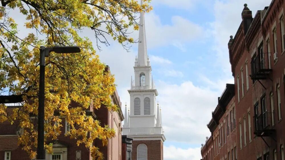
While you walk the Freedom Trail, admire Boston’s oldest surviving church building.
Photo by @embarkthepark
Get the right gear
Get the most out of your trip with comfortable, handy, and helpful hiking gear:
- This extra roomy fanny pack — from Chattanooga, TN-based company Burlaep — can carry all the gadgets and accessories you need for your hike.
- For the best footwear, check out Nordstrom Rack’s sneaker edit for hiking.
- If your trail demands a proper hiking boot, we like Columbia’s collection on Amazon.
- For apparel that’s both flattering and functional, we turn to small business Aesthetic Built. We love the oversized scuba hoodies for women and the muscle scallop tees for men.
- Sweat sustainably with SEAAV. Their activewear is not only performance-driven but also planet-friendly.
- Travel light (but still have room for snacks) with lululemon’s Everywhere Belt Bag.
- Get a good bulk deal on Perfect Bars, Clif Bars, or Kind Bars at a warehouse store like Sam’s Club.
- Whether it’s the Active Essentials Kit or the Vegan Victory Set, Fuel Goods delivers the goods to keep you going.
- Don’t forget to bring a compact, portable phone charger (you’ll thank us later).
- Bringing along your 4-legged friend? Hike in style with a new collar and leash.
- We like this Teton hiking backpack.
- We like this lightweight water bottle.
- Sweat sustainably with SEAAV. Their activewear is not only performance-driven but also planet-friendly.
- Whether it’s the Active Essentials Kit or the Vegan Victory Set, Fuel Goods delivers the goods to keep you going.
- Psst — to be ultra-prepared, here are the 10 items you should never enter a national park without, according to the National Park Service.


